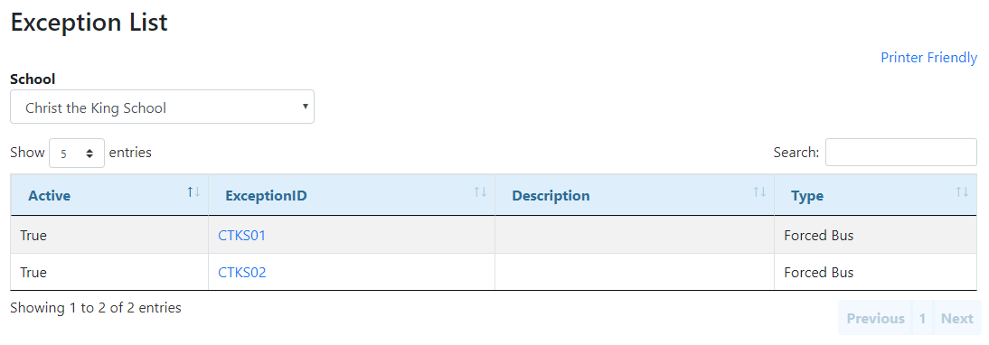
The Exception List tool creates a list of all the exception boundaries for an individual school. Clicking on an ExceptionID in the Exception List will redirect you to a map of the exception boundary.

Exception List Search Criteria
School – The school within the exception boundary to be queried.
 Exception List Results
•Active – Indicates whether or not the exception boundary is currently affecting students’ transportation eligibility. •Exception ID – The unique identification number of the exception boundary. •Description – The schools affected by the exception boundary, the grades affected by the exception boundary, and the reason for the exception boundary. •Type – The kind of exception boundary. |
 Exception Details
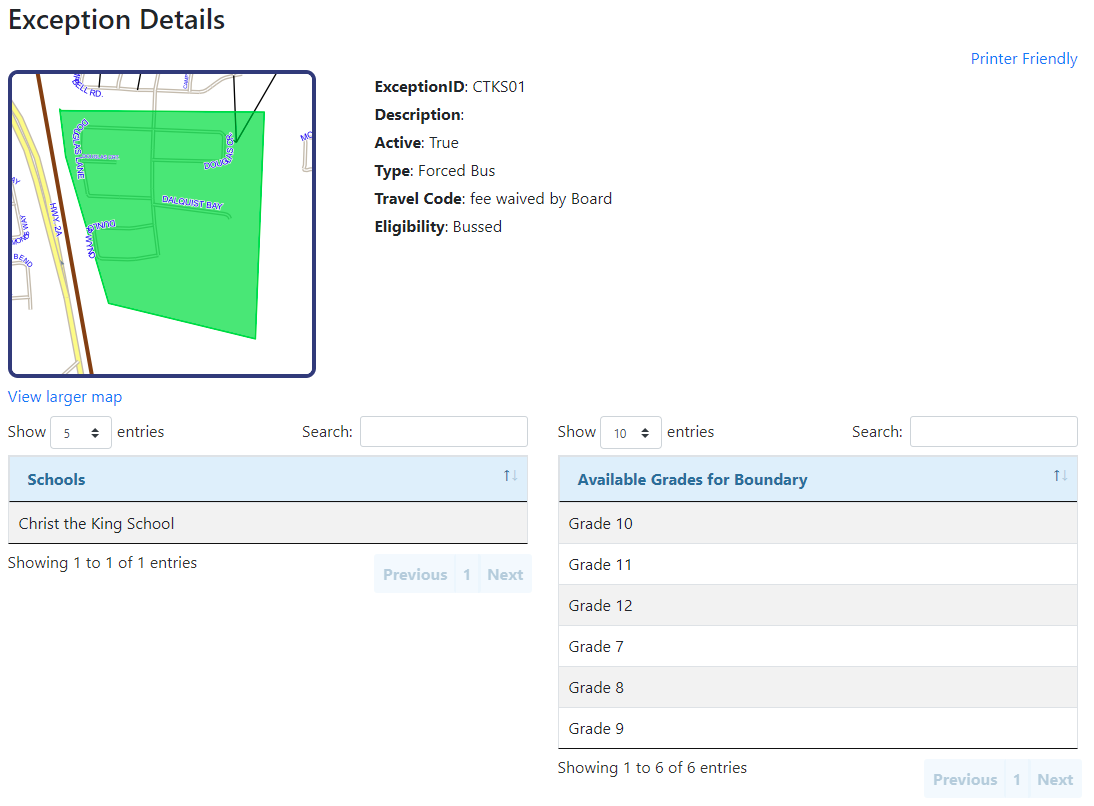
Clicking on an ExceptionID in the Exception List will redirect you to the Exception Details page, which includes more information about the selected exception boundary. The Exception Details page includes both attribute (descriptive) and spatial (map) information.
•Exception ID – The unique identification number of the exception boundary. •Description – The schools affected by the exception boundary, the grades affected by the exception boundary, and the reason for the exception boundary. •Active – Indicates whether or not the exception boundary is currently affecting students’ transportation eligibility. •Type – The kind of exception boundary. •Travel Code – The travel code applied to any student within the exception boundary. •Eligibility – The eligibility applied to any student within the exception boundary. •Schools – The schools affected by the exception boundary. •Grades – The grades affected by the exception boundary. •View Larger Map – A link to a larger map of the exception boundary. The View Larger Map page allows you to add additional layers to the map and to change the scope of the map. •Printer Friendly – A link to a new window which allows for easy printing of the on-screen information. |
